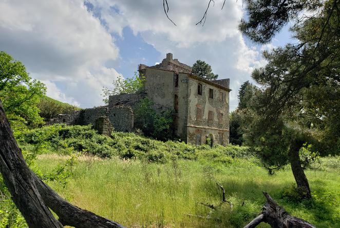
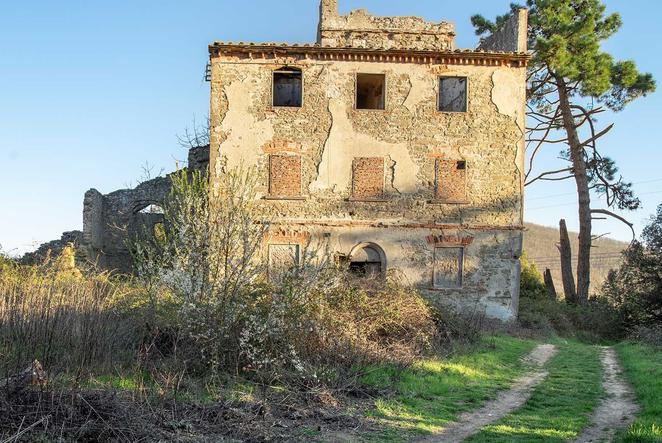
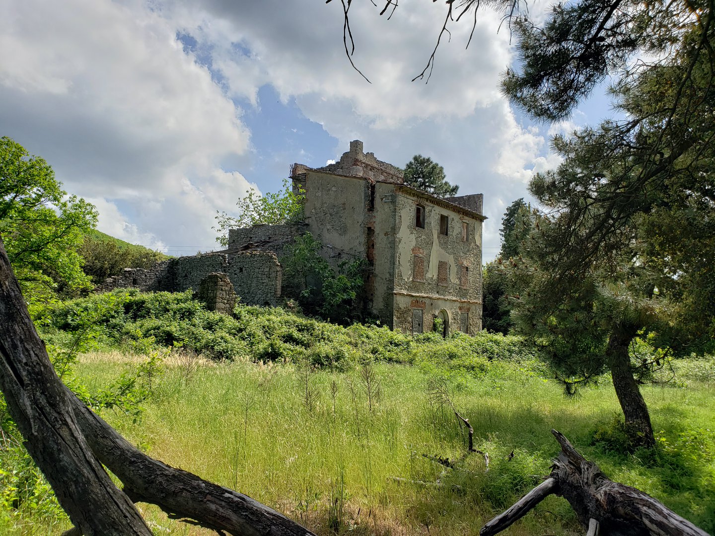
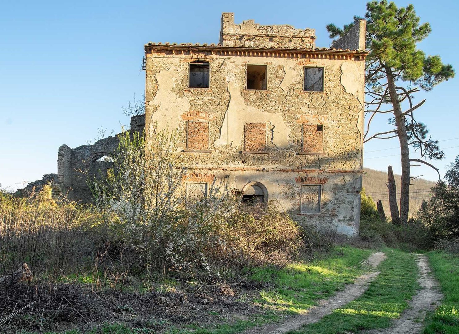
Tower of Sant'Alluccio
In the Middle Ages the Tower of Sant'Alluccio dominated the Montalbano at the point where from Vinci you head towards Bacchereto. At its feet are the springs of holy water, the stream that continues downstream with the name of Rio di Balenaia and then Vincio. Its history is closely linked to that of the ancient Counts Guidi hospital located near the gorge Balenaia. Probably already in Leonardo's time it belonged to the Florentine Ridolfi family. The complex of Sant'Alluccio, consisting of the stately building and rural outbuildings, once part of the countryside estate of Count Spalletti, is located inside the Barco Reale but is run down.
The tower, still recognizable today as part of the stately complex, is traditionally associated with the ancient hospital of Sant’Alluccio, which is said to have been founded by Santo Alluccio from Pescia, who lived between the 11th and 12th centuries. The church and the tower belonged to the countryside of Bacchereto, in the diocese of Pistoia, and on the ridge of Montalbano they marked the border between the counties of Pistoia and Florence. On the other hand, a hospital is mentioned in some documents of the mid-thirteenth century that link it to the family of the Counts Guidi, former lords of the castles of Cerreto and Vinci. Of the 14th-century church of Sant'Alluccio to which the tower was associated, there are no traces in the late 16th-century maps of the Captains of the Guelphs. So in the 16th century, of the old complex of Sant'Alluccio, only the tower that Leonardo designed in the map of the Lower Valdarno RL 12685 of Windsor (Santa Lucco) remained, placing it in a different position and with a lower structure at the base that resembles a church. Leonardo probably could have observed the tower along the road from Anchiano to Bacchereto.
Information
Address: Tacinaia, Quarrata
GPX coordinates: 43.8136419,10.9637536