-
Path
Useful Information
Total length
78,3 kmOverall positive altitude difference
2.480 mDifficulty
Medio/BassaOverall duration
4 or more daysItinerary
4 Stages, 2 rings, 9 Municipalities, 3 ProvincesMedici Villas Unesco Heritage sites
4Connection with
The Medici Route runs through a historically articulated and wide territory that mainly refers to Montalbano and the two large plains lying at its feet.
Montalbano is an area formed during the Middle Ages by a set of isolated castles and aggregated around the fortified centers which, having continuous contacts with larger realities such as the cities at its gates, opened up to events and historical-political dynamics and environmental conditions of the time.
In the Middle Ages, Montalbano was a frontier area with strategic importance and an intense military-territorial vocation, where large and wealthy families built numerous military structures that can be admired today along the Medici Route.
With the end of the Middle Ages and the beginning of the Modern Age, the Montalbano territory changed radically and from a military border area it became an articulated territorial system where plains, hills and the upper part of the mountain were integrated thanks to the Medici patrimonial and territorial policy.
Who were the Medici? This family rose to prominence around 1470, starting a slow patrimonial penetration in the area of Poggio a Caiano and the bordering marshy plain where the Laurenziana farmhouse will be built, not by chance it is the place where the Medici Route starts today.
Later they expanded towards Artimino and the upper part of the relief. Their expansion was so rapid that at the end of the fifteenth century the northern side of Montalbano was under the political, territorial and patrimonial hegemony of the Medici family.
With the Modern Age, the entire area in which Montalbano was in the center, saw the extension of a new presence of absolute importance: that of the Prince and his territorial possession policies. It was a new world and a new way of governing the territory, where traditional agricultural productions (oil, wine and wheat) were joined by new possible vocations (rice and animal breeding for dairy products) and recreation spaces (hunting and breeding of exotic animals).
These activities continued to develop over a long period - from the end of the fifteenth century to 1737 - in the territory between Prato and Fucecchio, passing through Poggio a Caiano, Carmignano, Artimino, Bacchereto, Vinci and Cerreto Guidi and up to Valdinievole, giving life to a real new landscape.
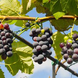
The Medici Route is a journey through history, a path that leads to discover a territory and its genesis through a centuries-old development, in which man's vision has changed the landscape and the territory, with wonderful and innovative works. A unique and original journey, to discover the Medici and their works such as: the four Medici Villas, UNESCO World Heritage Sites; the Medici's great passion for agriculture, science, nature and art shown today in the only museum in Italy dedicated to Still Life; historic villages; the harmonious landscape of vineyards and olive groves; historic wines such as the Carmignano, the first DOC in the world, established by Grand Duke Cosimo III de' Medici in 1716. Landscapes, works of art, architecture, nature and products intertwining with people and stories of the Medici family.Recommended equipment
35/40 liter backpack depending on the season; hiking shoes, pants and poles; microfiber socks; 2/3 microfiber and one cotton t-shirts for the night; a jumper; a windproof and water repellent breathable jacket; intimate changes and what you need for personal hygiene.
Gloves, leggings and hat in winter; sunscreen, cap and water supplement in summer.
Important advice: since dogs are not allowed to access Cascine di Tavola park, it is advisable, for those who will begin the route with dogs, to start from the area south of the Cascine, near Manetti Bridge.
-
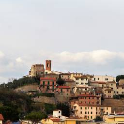
Stage 1: Prato - Artimino
Useful Information
Total length
19,2 Km
Difficulty
Medio/Bassa
Time needed to walk the stage
5h 40'
Time needed to walk the stage considering the stops
9h
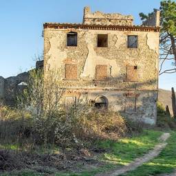
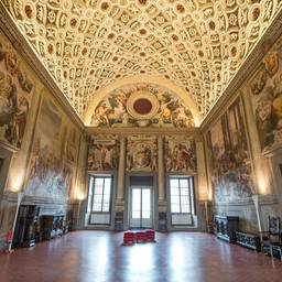
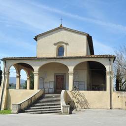
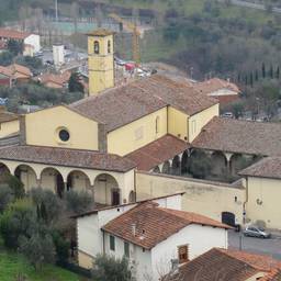
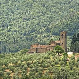
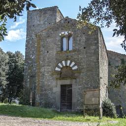
The first stage of the Medici Route offers three historical-artistic and landscape masterpieces of the entire route - the Cascine di Tavola, the Medici Villa in Poggio a Caiano and the Medici Villa "La Ferdinanda" in Artimino, both UNESCO heritage - wanted and built by the Medici family during the long period from the end of the 15th century to the beginning of the 17th century.
This stage of the Medici Route gives us the possibility to know and appreciate the evolution of the territorial policy of the Medici family, of its changes and mutations also in function of the political-economic, social and cultural conditions of the Tuscan and Italian situation of the time. These transformations are testified by the Cascine wanted by Lorenzo de 'Medici, a model of agricultural production of absolute avant-garde for the time, and the two Medici villas, symbols of magnificence and domain of the ruling house and demonstration of architectural and artistic models inspired by cultural currents: the one in Poggio a Caiano was more marked by Florentine mannerism while the one in Artimino anticipated the 17th-century artistic culture.
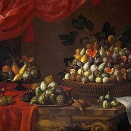
But it is the influence on the landscape as a whole that most characterizes this first stage of the Medici Route. A succession of historic villages, woods that have become hunting reserves, olive groves, vineyards, clearly visible works such as those already mentioned and other hidden ones such as the aqueduct of the Villa in Poggio a Caiano or the numerous works contained in the original and very rich Still Life Museum.
A clear sign of the harmonic vision of the landscape of the Medici family.Along the route
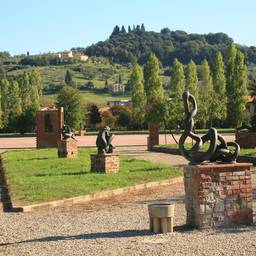
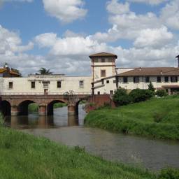
Cascine di Tavola Park
Leopoldo II Bridge
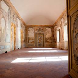
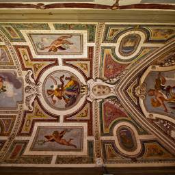
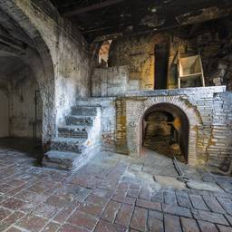
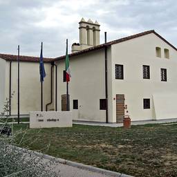
Medici Villa of Poggio a Caiano
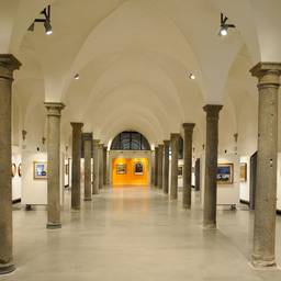
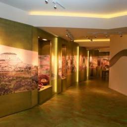
Still Life Museum
Medici Stables and Ardengo Soffici Museum
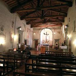
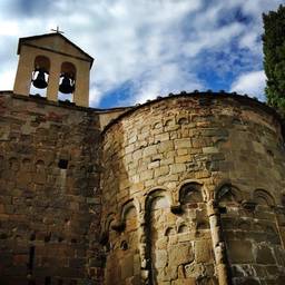
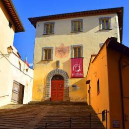
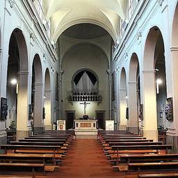
Church of S. Francesco in Bonistallo
Parish church of S. Michele and S. Francesco and Visitation
Vine and Wine Museum
Fortress of CarmignanoIn the surroundings
Quinto Martini Park Museum
Quinto Martini museum home
Boschetti Tumulus
Montefortini TumulusPoints of interest
-
Quinto Martini Studio House
Via Baccheretana, 306, Seano, Carmignano
-
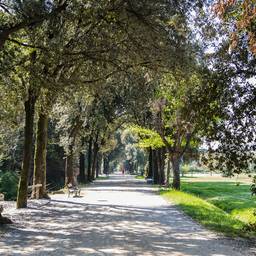
Cascine di Tavola Park
Via Traversa del Crocifisso, Tavola, Prato
-
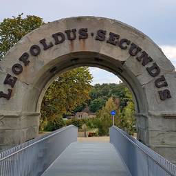
Leopold II Bridge
Via Regina Margherita, 26, Poggio a Caiano
-
Medici Villa of Poggio a Caiano
Piazza dei Medici, 14, Poggio a Caiano
-
Still Life Museum
Piazza Medici, 14, Poggio a Caiano
-
Medici Stables
Via Lorenzo il Magnifico, 9, Poggio a Caiano
-
Ardengo Soffici Museum
Via Lorenzo il Magnifico, 9, Poggio a Caiano
-
Church of San Francesco in Bonistallo
Via Bonistallo, 9, Bonistallo, Poggio a Caiano
-
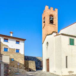
Parish church of San Michele and San Francesco
Piazza Santi Francesco e Michele, 1, Carmignano
-
Vine and Wine Museum
Piazza Vittorio Emanuele II, 16, Carmignano
-
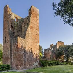
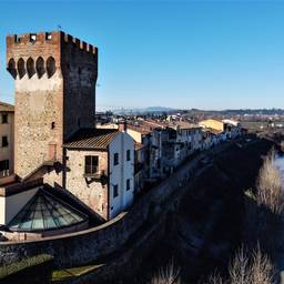
Fortress of Carmignano
Via del Castello, 1, Carmignano
-
Quinto Martini Museum Park
Via Pistoiese, Seano, Carmignano
-
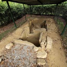
Boschetti Tumulus
Via Lombarda, Comeana, Carmignano
-
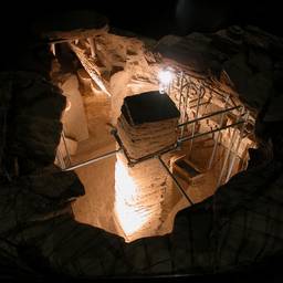
Etruscan tumulus of Montefortini
Via Montefortini, Comeana, Carmignano
-
Stage 2: Artimino - Bacchereto
Useful Information
Total length
22,1 km
Difficulty
Medio/Alta
Time needed to walk the stage
6h 15'
Time needed to walk the stage considering the stops
7h 25'
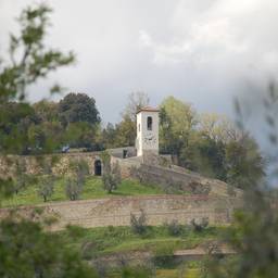
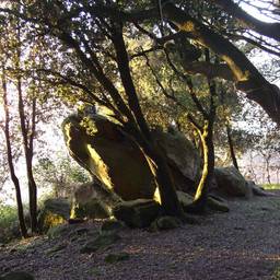
The second stage, together with the third, is the most 'naturalistic' of the entire route, developing first on the highest belt of the hills of the northern side of Montalbano, and then on the ridge of this relief, which has always been covered by woods from the end of the Middle Ages until today.
In this area it is very clear and still visible today, the dividing line between nature and the landscape built by man during the centuries.
In the plain there are historically cultivated areas that go up the slopes of Montalbano as far as the shape and the slope of the relief allowed it, two characteristics of the territory that have strongly influenced the technique and technology available to man over the centuries.
On these lands, a real agricultural supply since the Middle Ages for the nearby cities of Pistoia (first) and Florence (after), were concentrated the signs and interventions made by the Medici with their farms, with the start of quality agriculture, such as the Grand Ducal wine production characterized by the Cosimo III edict in 1716, the great hunting reserve of Barco Reale, symbol of an era that united the courts of the whole of Europe.
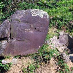
Here and there, the itinerary shows the signs of eras that preceded the Medici period, from Ancient times to the Middle Ages, which distinguish the upper part of Montalbano still today, such as the Etruscan settlements, churches and abbeys. The woods of Montalbano, some natural elements such as the monoliths of hard sandstone and important and original plant species remain in memory of the periods when Nature was the protagonist and imposed its laws on a man equipped with rudimentary technology.Along the route
La Ferdinanda Medici Villa
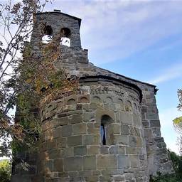
Parish church of S. Leonardo
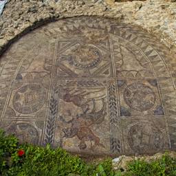
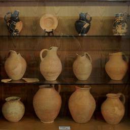
Archaeological Museum "Francesco Nicosia"
Etruscan necropolis of Prato Rosello
Parish church of S. Martino in Campo
Abbey of S. Giusto
Archaelogic area of PietramarinaPoints of interest
-
La Ferdinanda Medici Villa
Viale Papa Giovanni XXIII, 1, Artimino, Carmignano
-
Parish church of San Leonardo
Via della Chiesa, 23, Artimino, Carmignano
-
Archaeological Museum of Artimino
Piazza San Carlo, 3, Artimino, Carmignano
-
Etruscan Necropolis of Prato Rosello
Poggio alla Malva, Carmignano
-
Parish church of San Martino in Campo
Via San Martino in Campo 1, Capraia e Limite (FI), Capraia e Limite
-
Abbey of S. Giusto
Via Montalbano, Verghereto, Pinone, Carmignano
-
Archaeological area of Pietramarina
Il Pinone, Carmignano
-
Stage 3: Bacchereto - Vinci
Useful Information
Total length
18 km
Difficulty
Media
Time needed to walk the stage
6h 40'
Time needed to walk the stage considering the stops
8h
The third stage, which covers both the upper part of Montalbano and its southern slopes, overlooking the Valdarno di Sotto, is characterized by both the most naturalistic aspect - in which man's work is always visible, however - and by the historical-architectural one, where the Middle Ages prevail, even if there are signs and works of the following centuries.
The ridge of the mountain offers strips of forest of absolute naturalistic importance and offers rare panoramic views, open on the large basin of Florence and Pistoia, thus showing how man has managed and manages spaces in the use of natural resources. The southern side instead offers panoramas ranging from the Valdarno di Sotto, to Mount Serra, from the Apuan Alps to the Pistoia Apennines.
The comparison between these two types of panoramas offers moments of reflection to the walking tourist. In fact, the upper part of the northern Montalbano is so steep, wooded and shaded, while the southern part is homogeneously sloping, characterized by cultivated fields that go back almost to the ridge and by historical buildings lying on its terraces. A very clear morphological diversity in which emerges the different use that the man has made of the soil and its resources in the entire Montalbano area throughout its history.
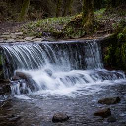
Finally, the mills near the numerous streams that descend from the upper part of the mountain, are evidence of the use by man of hydraulic energy in the long period preceding the arrival of the steam (first) and the electricity in the countryside (after). Vinci and Leonardo's engineering genius constitute the emblem of this stage of the Medici Route.Along the route
Tower of Sant'Alluccio
Church of S. Maria in Orbignano
Leonardo Museum
In the surroundings
Leonardo's Birthplace -
Stage 4: Vinci - Fucecchio
Useful Information
Total length
19 km
Difficulty
Bassa
Time needed to walk the stage
5h 40'
Time needed to walk the stage considering the stops
6h 40'
The fourth stage of the Medici Route, like the first, runs through a hilly, soft and winding landscape. But the similarity is only apparent, as the hills are different in geological origin and because of the events that characterized the formation of the Florence-Prato-Pistoia basin. Here it is evident how man throughout history has been able to draw natural resources from the landscape to face the difficulties and constraints posed by nature. The cultural factor has been able to 'suggest' to the man of the time tools and solutions from completely different and distant contexts, thanks to the presence of the Via Francigena.
As the path from Montalbano leads to Fucecchio, the landscape loses not only the woody aspect but also its harsher one; rounded profiles of centuries-old hills in continuous 'movement' for their geological (purely clayey) constitution, which only a grueling plurisecular work carried out by generations of peasant families, organized on the sharecropping contract, was able to stabilize, preventing it from slipping down. A painstaking job, repeated for centuries through simple but good agricultural tools; a work that regulated the shallow waters with a series of terraces and that had an aesthetic result known and admired all over the world (the countryside of central Tuscany). An authentic garden, as Tuscany has been defined during the 18th and 19th centuries by foreign travelers on the Grand Tour. A landscape that we find and can also admire in Leonardo Da Vinci's paintings.
Along the way there is the third Medici Villa of the entire Route, the Villa of Cerreto Guidi, a UNESCO heritage site, another fundamental stage of the Medici Route. The route continues towards Fucecchio along one of the very few Italian marshlands, the Fucecchio Marshes, which covers the entire Montalbano from the north-west across the Valdinievole. Right on the edge of this basin, where the waters and the mainland mutually exchange rule, man over time has had to adopt a completely different lifestyle - economy of the marshes - compared to that exhisting in the neighboring hills and in the Montalbano. Here the Medici implemented another decisive territorial policy. It was in fact Cosimo I de 'Medici who commissioned the hydraulic scientists at his service to arrange the water supply of the lake to make it a vast basin for fishing.Along the route
Medici Villa of Cerreto Guidi
Local Memory Museum - MuMeLoc
Corsini Palace and Museum
Corsini Park and Florentine fortress
Montanelli Bassi Foundation
In the surroundings
Fucecchio Marshes
Medici Bridge of CappianoPoints of interest
-
Montanelli Bassi Foundation
Via G. di San Giorgio, 2, Fucecchio
-
Medici Villa of Cerreto Guidi
Via dei Ponti Medicei, 7, Cerreto Guidi
-
Local Memory Museum - MuMeLoc
Viale Vittorio Veneto, Cerreto Guidi
-
Palazzo Corsini and museum
Piazza Vittorio Veneto, 27, Fucecchio
-
Corsini park and Florentine fortress
Piazza Corsini, Fucecchio
-
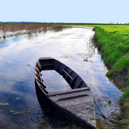
Fucecchio Marshes
Fucecchio
-
The Medici Bridge of Cappiano
Ponte Cappiano, Fucecchio
-
La Magia Ring - Quarrata
Useful Information
Total length
15 km
Difficulty
Media
Time needed to walk the stage
4h 30'
Time needed to walk the stage considering the stops
5h 30'
The Magia ring in Quarrata: from the Pistoia countryside to the Medici hunting territorial system
During the Middle Ages and the Modern Age, the territory of Quarrata was an integral part of that of Pistoia and faithfully followed its fate and historical-settlement evolution.
The territory of Pistoia, besides the mountain and the hill, also included a narrow strip of plain which was characterized by its not excellent production potential. Over the centuries Pistoia's ability to impose itself on its countryside as the top of the territorial organization remained unchanged, able of giving a considerable degree of urbanization with important effects on the historical development and on the structure of the population and settlement. It is also to this strong city influence that the typical "fragmentation" is owed, also marked by the morphology of the hilly part, where the map of the population was fragmented and distributed in a myriad of very divided micro-inhabited areas, preventing the birth of relevant inhabited centres. The best example of this micro-settlement fragmentation is represented today by that part of the hill behind Quarrata that climbs towards the wooded ridge of Montalbano. In this regard even at the time of the Lorraine Land Registry (1820-'30) the maps of Quarrata show a rarefied settlement fabric, distributed homogeneously both on the hill and in the plain immediately below, without dominant urban areas except the large complex of La Magia.Tiny groups of houses can be seen at the intersections of the inter-provincial road system, in addition to the scattered rural houses, an integral part of the sharecropping system.
This peculiarity began to change with the arrival of the Medici Family, interested since the time of Lorenzo in large areas located west of Florence, mostly occupied by marshes, swamps and ponds, therefore little sought after by the noble families of Pistoia and Lucca. The succession of the first three Grand Dukes led to an ever closer connection between Pistoia and the Medici Family; the bond that affected the entire territory that was once the city's countryside, especially the more fertile one represented by the hills that stood between the still marshy plain and the upper part of Montalbano. Just these lands were used for the production of cereals, wine and oil.
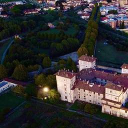
In the process of rapprochement that bound the Pistoia territory in an ever closer way to the Medici Family, an important step was represented by the purchase by Francesco I of Villa la Magia in 1583, placed on the road between Florence and Pistoia, already owned by the Panciatichi family from the early decades of the fourteenth century. The Villa becomes an important element among the properties of the Medici Family, especially in relation to the adjacent Barco Reale demonstration of how hunting in the sixteenth century represented for the crowned heads a business card of their own rank nobility. Proof of this is the passage from Villa La Magia of Emperor Charles V in May 1536.Along the route
La Magia Medici Villa -
Capraia and Montelupo Ring
Useful Information
Total length
14 km
Difficulty
Bassa
Time needed to walk the stage
3h
Time needed to walk the stage considering the stops
4h
The Capraia and Montelupo Ring inserts the extreme south-eastern part of Montalbano mountains into the Medici Route, the one that, overlooking the Arno, finds its natural limit in the river, which separates Montalbano from the Roveta reliefs, geologically and morphologically similar. This part of Montalbano area had a different long-term settlement history and local dynamics have built a different historical landscape. An example above all is having offered the natural way for several centuries to the flows of flocks that descended from Pistoia Apennines to Maremma at the end of the summer and then returned there at the end of spring, when - owing to the heat in the southern Tuscany area - the stay was not recommended due to the presence of Anopheles mosquitos. It is no coincidence that the village of Camaioni was also the place where the ship that took care of ferrying men, animals and goods from one shore to the other existed. The ring then offers hikers the possibility of an easy and 'silent' walk along the Arno river thanks to the presence of the cycle-pedestrian path that uses the embankment of the old Florence-Pisa railway, the first built in the mid-nineteenth century in the Grand Duchy of Tuscany, some remains of which can still be seen.
The passage of the route in the two villages of Montelupo Fiorentino then allows the possibility of a visit (for now only external) to another of the villas built by the Medici, the Ambrogiana, recently abandoned from the function covered for a century and a half as a judicial psychiatric hospital and awaiting new public use. The crossing of Capraia - a medieval castle and then a walled village built on a spur of rock close to the Arno river with a suggestive view of the castle of Montelupo Fiorentino - anticipates the not tiring ascent of the southern slope of Montalbano. Given its extremely different morphology compared to Prato side of the mountain, the historical landscape is characterized by the presence of farms and farmhouses, now home to as many accommodation facilities, useful for hiker-tourists for stops and pleasant encounters with local people.GPS coordinates starting point of the ring (Podere l'olivo): 43 ° 46'38.02 "N - 11 ° 02'26.14" E
Along the route
Pasquinucci Furnace
Ceramics Museum
Ambrogiana Medici Villa
Frescobaldi Tower
Camaioni Wood
S. Stefano Church
Montelupo Archaeological Museum
Capraia Castle
S. Giovanni Church
S. Martino in Campo ChurchIn the surroundings
Points of interest
-
Vetti Roman Villa
Via G. Palandri, 45, Oratorio, Limite sull'Arno, Capraia e Limite
-
The Medici Villa dell'Ambrogiana
Via del Parco, Montelupo Fiorentino
-
Egg Tomb
Pulignano, Capraia e Limite
-
Pasquinucci Furnace
Piazza Dori, 2, Capraia e Limite
-
Camaioni Wood and Church of San Michele in Luciano
Via San Vito, Luciano/Antinoro, Montelupo Fiorentino
-
Church of San Giovanni Evangelista
Via Baccio da Montelupo, 37, Montelupo Fiorentino
-
Archaeological Area of Montereggi
Capraia e Limite
-
Archaeological Museum of Montelupo Fiorentino
Piazza Vittorio Veneto, 10/11, Montelupo Fiorentino
-
Capraia Castle
Capraia e Limite
-
Frescobaldi Tower
Via Torre, 8, Montelupo Fiorentino
-
Church of Santo Stefano
Piazza Vittorio Pucci, 1, Capraia e Limite
-
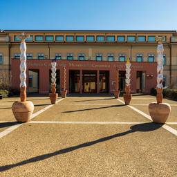
Ceramics Museum
Piazza Vittorio Veneto, 10, Montelupo Fiorentino
-
Parish church of San Martino in Campo
Via San Martino in Campo 1, Capraia e Limite (FI), Capraia e Limite